


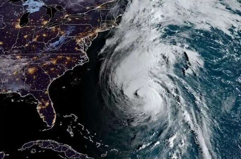


Hurricane Lee, although its winds have weakened, continues to pose a significant threat as it approaches New England and the Canadian Maritimes. The storm has now been categorized as a Category 2 hurricane, according to the US National Hurricane Center. While the winds have dropped to 100 miles per hour, Lee's size continues to expand, making it a cause for concern.
The potential impacts of Hurricane Lee are far-reaching and include coastal flooding and power outages. Tropical storm and hurricane watches have been issued from Rhode Island to Nova Scotia. Additionally, Bermuda is also expected to face the brunt of Lee's winds as it passes by on Thursday.
As Hurricane Lee moves past Massachusetts, its counter-clockwise motion is expected to push storm surge into Cape Cod Bay, posing a significant risk to the communities located south of Boston. Experts are referring to the storm surge warning in Cape Cod Bay as an unusual occurrence.
The winds are anticipated to increase across southern New England, including Boston, on Friday evening. By early Saturday morning, eastern Maine and New Brunswick will experience stronger winds as the hurricane is likely to make landfall there later in the day.
Despite weakening due to wind shear and dry air, Hurricane Lee previously reached a Category 5 storm with winds of 165 miles per hour, making it the strongest Atlantic storm of the year. It is expected to transition into a post-tropical storm as it reaches the Canadian coast. However, it is important to note that the storm will still pose dangers despite its changed structure.
The Atlantic Ocean has already produced a total of 14 storms, including one unnamed system in January. This is above the average for this time of the year, as typically only about nine storms would have formed by now, according to hurricane researcher Phil Klotzbach from Colorado State University.
In other weather news, Europe is set to experience continued autumn heat throughout the next week. This heat will be accompanied by severe thunderstorms and heavy rainfall from Spain to Germany. While temperatures across most of France and Germany will remain above the seasonal average, the UK is expected to have near-average weather next week, with more unsettled conditions bringing strong winds and rain from the Atlantic.