


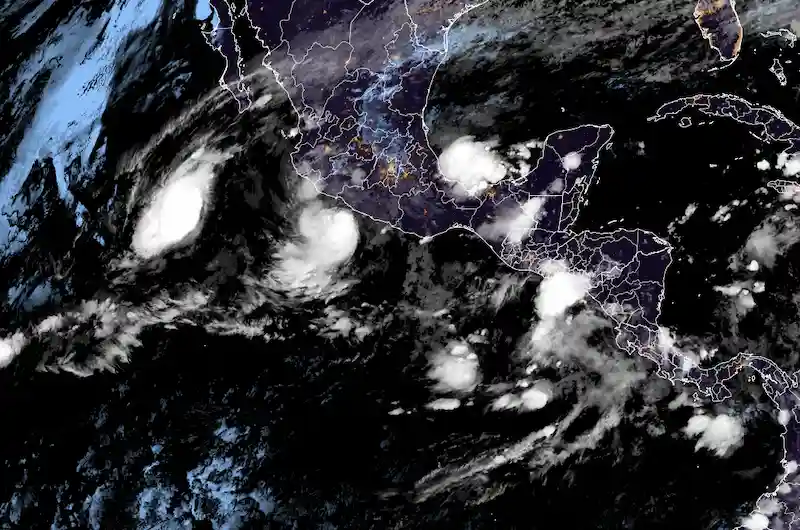


Tropical Storm Max is intensifying as it progresses towards the coast of Mexico. The storm is expected to make landfall somewhere between Acapulco and Punta San Telmo on Monday, according to the US National Hurricane Center. The center has cautioned that Max will likely bring heavy rainfall, with potential rainfall amounts ranging from four to eight inches, and even up to 12 inches in certain areas. Mexican states such as Guerrero, Michoacan, and western Oaxaca’s coastal regions are expected to experience the brunt of the storm's impacts.
The rainfall brought by Max has the potential to cause flash flooding, urban flooding, and mudslides, particularly in high elevation areas near the coast. The US National Hurricane Center has highlighted the states of Guerrero, Michoacan, and coastal portions of western Oaxaca as areas at risk. As the storm gains strength, residents and authorities in these regions are urged to remain vigilant and take necessary precautions to ensure their safety.
Simultaneously, Tropical Storm Lidia is also advancing across the Pacific and is expected to reach hurricane strength as it approaches Islas Marias and the west-central coast of Mexico on Tuesday. Similar to Tropical Storm Max, Lidia is projected to bring heavy rainfall, ranging from four to eight inches and possibly up to 12 inches across Nayarit, southern areas of Sinaloa, and coastal regions of Jalisco. These areas should anticipate the possibility of flooding and potential damages associated with the storm.
In the Atlantic region, there are two potential storms of interest. One is situated off the coast of Africa and currently holds an 80% chance of developing into the next named storm this season. The other system, located in the southern Gulf of Mexico, has a lower probability of becoming a named storm, with only a 10% chance. Nevertheless, it is worth monitoring as it approaches the Bay of Campeche, an important source of oil and natural gas for Mexico.
Turning to Hong Kong, the city has resumed normal operations as it recovers from the effects of Typhoon Koinu. Storm and rain warnings have been lowered, allowing businesses to resume and the stock market to reopen. Fortunately, the typhoon has moved away from the area, leading to a decrease in potential threats.
Additionally, Tropical Storm Bolaven is currently veering away from Japan, alleviating concerns for now. It is important, however, to stay updated on weather developments as conditions can change rapidly.
Residents and governments in the affected areas are urged to closely monitor the progression of these storms, follow official instructions, and take necessary precautions to ensure the safety and well-being of both individuals and communities.