


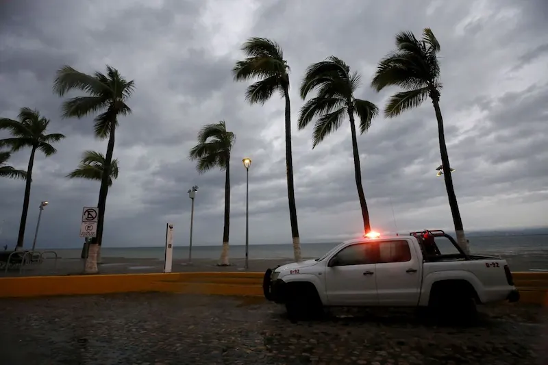


Hurricane Lidia, a powerful Category 4 storm, made a devastating impact as it struck Mexico's Pacific coast near Cabo Corrientes. With wind speeds reaching an alarming 140 miles per hour, Lidia rapidly intensified just hours before landfall. This level of intensification is known as "rapid intensification," a phenomenon that is becoming more common as climate change warms the world's oceans. It poses a significant danger as it can catch residents and emergency officials off guard due to the storm's sudden and drastic increase in strength.
According to meteorologist Jeff Masters, Lidia is now tied as the third-strongest hurricane to hit Mexico's Pacific coast. The only storms to exceed its strength were recorded in 1957, 1959, and 2002. The most powerful storm to have struck the region thus far was Hurricane Patricia in 2015, which boasted winds of 150 miles per hour. These records highlight the severity of Lidia's impact and shed light on the increasing frequency of intense storms in the region.
While Lidia has since dissipated over Mexico's western region, its torrential rains continue to pose a threat. The heavy rainfall can lead to flash floods and mudslides, exacerbating the damage caused by the hurricane's powerful winds. Residents in the affected areas must remain vigilant and take necessary precautions to ensure their safety.
In other weather developments, Tropical Storm Sean has formed in the far Atlantic, with winds of 40 miles per hour. However, it is not expected to pose a significant threat to land at this time. Meanwhile, Super Typhoon Bolaven looms in the Western Pacific, maintaining its Category 5 status with 166 mile per hour winds. Currently on track to veer away from Japan, it is projected to pass south of Alaska's Aleutian Islands. Storms following this trajectory often result in temperature fluctuations across Canada and the US in the subsequent weeks.
As for the United States, the water levels in the Mississippi and Ohio River systems are steadily declining. In fact, three gauges on the Mississippi in Missouri and Tennessee recorded their all-time lowest levels earlier this week. Additionally, the gauge on the Ohio River at Cairo, Illinois hit its lowest mark since 1901 on Sunday. These dwindling water levels raise concerns about the impact on river navigation, water supply, and overall ecosystem health.
Lastly, Europe braces for its first taste of winter as a sudden cold snap descends upon the continent, challenging its energy systems. The abrupt change in temperature will undoubtedly test the region's ability to meet heating demands and efficiently deliver energy to households and businesses. This extreme weather event serves as a reminder of the vulnerability of energy infrastructure in the face of changing climate patterns.
Overall, these various weather events highlight the ongoing challenges posed by climate change and the need for preparedness and resilience in the face of extreme weather conditions.