


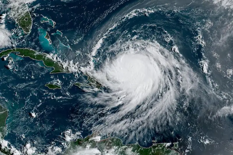


Hurricane Erin, which only days ago had been roaring across the Atlantic with the destructive force of a Category 5, has weakened noticeably. By early Sunday, U.S. forecasters confirmed that the storm had lost some of its ferocity, slipping down to Category 3 as its winds slowed to around 125 miles per hour. That’s still enough to rip off roofs and batter coastal communities, but it is a marked change from the terrifying 160 mph winds Erin had briefly sustained when it reached peak intensity.
The storm was tracking roughly 330 miles east-southeast of Grand Turk Island, drifting west-northwest at about 14 mph. Officials expect it to slow its pace through Sunday before curving northward at the start of the week. That trajectory could spare some of the most vulnerable Caribbean islands from a direct hit, though the outer bands of Erin remain wide enough to stir up dangerous seas across a broad swath of the region.
By Sunday morning, weather agencies in France and the Netherlands had already canceled their tropical storm watches for St. Martin, St. Barthelemy, and Sint Maarten, suggesting the threat to those islands had diminished. Still, forecasters at the U.S. National Hurricane Center warned that conditions were far from calm. Erin’s powerful swells were expected to pound the northern Leeward Islands, the Virgin Islands, Puerto Rico, Hispaniola, and the Turks and Caicos over the next couple of days. Those waves are forecast to push farther outward early this week, reaching Bermuda, much of the U.S. East Coast, and even parts of Atlantic Canada.
Rough surf and rip currents pose some of the most immediate dangers for communities along the water. Authorities have repeatedly stressed that even if Erin never makes landfall, the seas it stirs could be deadly for swimmers and boaters. The Bahamas has already issued a Tropical Storm Watch for the British territories of the Turks and Caicos, highlighting the uncertain nature of Erin’s path.
Beyond the traditional threats of flooding and storm surge, meteorologists are also monitoring an unusual risk. Andrew Siffert, a senior meteorologist with BMS Group, raised the possibility that Erin could evolve into a potent offshore system, driven not by tropical warmth but by the clash of warm and cold air masses. If that happens, dry winds rushing ahead of the storm could combine with parched landscapes to raise the specter of wildfires—an ironic danger linked to a hurricane.
Insurance firms, meanwhile, are watching Erin closely, though so far the outlook is less alarming for the continental United States. Twelve Securis, which manages insurance-linked securities, said forecasts continue to suggest that the storm will remain far enough offshore to prevent major impacts on the East Coast. Still, the Atlantic season is only just beginning, and Erin’s dramatic shifts in strength serve as a reminder of how unpredictable these storms can be.
For now, Erin remains powerful but less menacing than it was just days ago. Whether it weakens further or finds new energy as it curves north will determine how much of a mark this first hurricane of 2025 leaves on the Atlantic basin.