


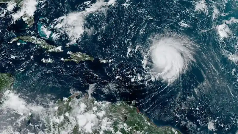


Category 3 Hurricane Lee remains several hundred miles east of the Caribbean islands, but forecasters warn that its effects may reach the US Atlantic seaboard as early as this weekend. Currently located about 350 miles east-northeast of the northern Leeward Islands, Lee packs maximum sustained winds of 115 mph and is predicted to retain its strength on Saturday before potentially strengthening again over the weekend.
While it is still too early to determine whether the core of the storm will make landfall on the US mainland, Lee is expected to generate rip currents and large waves along most of the East Coast of the United States on Sunday and Monday, which could worsen throughout the week. The US National Hurricane Center cautions that hazardous beach conditions are likely to develop across the western Atlantic in the coming week. Caribbean islands, including Puerto Rico, the Virgin Islands, and the northern Leeward Islands, are also expected to experience the impact of the storm, although it is projected to pass "well to the north" of them.
Lee achieved a remarkable level of strength that few storms ever reach. Only 2% of storms in the Atlantic reach Category 5 status, and including Lee, only 40 Category 5 hurricanes have occurred since 1924. In just 24 hours, Lee's winds intensified by 85 mph, tying Hurricane Matthew for the third-fastest rapid intensification in the Atlantic. Warm ocean waters and favorable atmospheric conditions contributed to Lee's rapid strengthening.
The warmest summer on record contributed to sea-surface temperatures in the Atlantic Ocean that are 2 degrees Celsius (3.6 degrees Fahrenheit) above normal along Lee's path, according to Florida's state climatologist. Reaching Category 5 strength has become more common in recent years, with Lee being the eighth such storm since 2016. It is worth noting that all seven ocean basins where tropical cyclones form have experienced a Category 5 storm in 2023.
As for Lee's potential impact on the US, computer models suggest that the hurricane will turn northward early next week. The strength and positioning of high-pressure systems and the jet stream will influence how closely Lee approaches the East Coast. If the jet stream sets up along the coast, it will act as a barrier, keeping Lee further away but potentially bringing it closer to Bermuda. Conversely, if the high pressure remains strong, Lee may make a slower turn to the north, leaving parts of the East Coast vulnerable to a closer approach.
At this stage, the specific track of Hurricane Lee and its potential impact on the US are uncertain. It is essential to closely monitor the storm's movement in the coming days as it continues to develop and gather more data.