


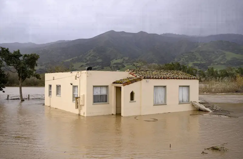


The West Coast of the United States, particularly California, is under threat of severe flooding as a potent plume of moisture known as an atmospheric river heads its way from January 30th to February 3rd. The US Climate Prediction Center has raised the alarm, stating that there is a 60% to 80% chance of above-normal rain and snow along the West Coast and across the Southwest. These atmospheric rivers are powerful weather phenomena that originate in the Pacific Ocean and can deliver rainfall equivalent to that of the entire Mississippi River. While mild events can be beneficial, stronger systems have the potential to cause widespread destruction, flooding, and even loss of life through mudslides.
Last year, a series of atmospheric rivers claimed at least 22 lives in California and led to $4.6 billion in damage and losses, according to the National Centers for Environmental Information. With the upcoming event, the Climate Prediction Center warns of hazardous high winds impacting the West Coast, particularly from the Pacific Northwest down to California. These persistent strong winds could result in coastal erosion due to the high waves they generate.
Alongside the heavy rainfall and snowfall, temperatures are expected to rise across a large portion of the contiguous US. The upper Midwest and Great Lakes area have the highest likelihood of experiencing milder air. This pattern of atmospheric flow suggests that mild temperatures will prevail across most of the Northern Hemisphere. As a result, winter's grip appears to be loosening across the eastern US.
In specific weather news, the UK is bracing for another round of high winds and rain as storm Jocelyn makes its way across the country. This comes in the aftermath of winter storm Isha that caused significant damage earlier in the week. Amber wind warnings have been issued around the Scottish coast, indicating the possibility of power outages, fallen trees, and blocked roads. The rest of the UK, excluding southeast England, has a yellow warning in place for heavy rain. In northern Scotland, gusts of up to 80 miles per hour are expected in exposed areas, according to the UK Met Office.
Meanwhile, Australia is also preparing for extreme weather conditions. Queensland's coast is in the direct path of a potential tropical cyclone that could hit near Ayr on Thursday into Friday. The anticipated Category 2 system on Australia's scale is likely to bring widespread flooding rain to the region. Additionally, forecasters at the Australian Bureau of Meteorology stress the possibility of a substantial flood event occurring in inland parts of Queensland over the weekend.
These various weather scenarios highlight the ongoing challenges posed by extreme weather events. As climate patterns shift, it is crucial to remain vigilant and prepared for the potential risks and impacts associated with such phenomena.