


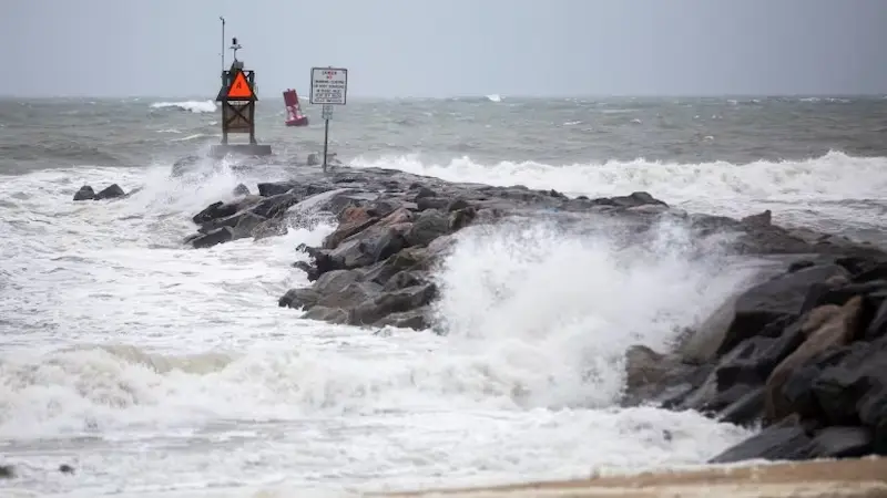


Residents in coastal areas of North Carolina and Virginia experienced severe flooding on Saturday as Tropical Storm Ophelia made landfall near a barrier island in North Carolina. The storm brought heavy rain, damaging winds, and dangerous surges, with near-hurricane-strength winds of 70 mph (113 kph) recorded at landfall. As the storm moves northwards, it is expected to weaken and then shift northeast. However, even before making landfall, Ophelia proved treacherous, as five people had to be rescued by the Coast Guard from a stranded boat on Friday night.
Videos shared on social media showed communities along riverfronts in North Carolina like New Bern, Belhaven, and Washington experiencing significant flooding. The storm is forecast to continue bringing windy conditions and heavy rainfall as it moves up the East Coast at a speed of about 13 mph (21 kph). North Carolina and Virginia could see up to 8 inches of rainfall, with 2 to 4 inches expected in the rest of the mid-Atlantic region through Sunday. Some New Jersey shore communities, including Sea Isle City, have already reported flooding.
Philippe Papin, a hurricane specialist with the National Hurricane Center, warned of the risk of flooding due to heavy rain in the next couple of days. While tropical storm-force winds are gradually subsiding, the main concern remains the significant rainfall threat, especially for eastern North Carolina and southern Virginia. Power outages have also been reported in multiple states beyond North Carolina, with tens of thousands of homes and businesses still without electricity. Fallen trees and limbs from the storm have been causing disruptions in power supply.
The North Carolina Division of Emergency Management has reported downed trees, but no major road closings so far. A storm surge warning has been issued from Ocracoke Inlet, North Carolina, to Chincoteague, Virginia, indicating the danger of rising ocean water pushed inland by Ophelia. Surges between 3 and 5 feet (0.9 and 1.5 meters) were forecasted in certain areas. A tropical storm warning has also been issued from Cape Fear, North Carolina, to Fenwick Island, Delaware.
On Friday, the governors of North Carolina, Virginia, and Maryland declared states of emergency, resulting in the cancellation of several weekend events. The North Carolina Ferry System has suspended its services on all routes until conditions improve. The Washington Nationals baseball team postponed its Saturday game until Sunday. In anticipation of the storm's impact, residents in vulnerable areas took precautions, such as picking up sandbags, to protect their properties from potential flooding and damage.
It is not uncommon to see tropical storms and hurricanes develop off the East Coast during this peak hurricane season. Climate scientists suggest that climate change may increase the likelihood of these storms and their reach into mid-latitude regions. One study indicates that hurricanes could track closer to the coasts, including areas like Boston, New York, and Virginia, and be more prone to form along the Southeast coast. Such weather events serve as a reminder of the need for preparedness and resilience in the face of an ever-changing climate.