


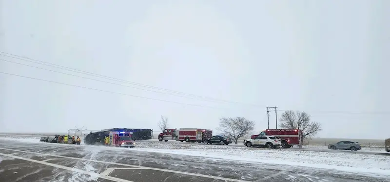


A powerful winter storm is wreaking havoc across the central United States, unleashing heavy snow, freezing rain, and strong winds. Travel during this busy holiday week has become treacherous as blizzard conditions make it "difficult to near impossible" to get around, warns the National Weather Service.
Blizzard warnings are in effect for parts of Nebraska, South Dakota, Kansas, Colorado, and Wyoming on Tuesday. The combination of intense snowfall and strong winds exceeding 50 to 60 mph, with occasional gusts up to 75 mph, has the potential to topple trees and power lines. Visibility will be reduced to a quarter-mile or less for at least three hours in affected areas.
The National Weather Service has issued a stern warning about widespread travel disruptions throughout the region, urging residents to avoid unnecessary travel. However, if travel is unavoidable, it is essential to have survival kits in vehicles in case of stranding.
Snow accumulation forecasts indicate that portions of South Dakota, Nebraska, and Wyoming could receive an additional six inches or more on Tuesday. Some locations may witness over a foot of snowfall from Monday through Tuesday, making it an arduous task for road crews to keep up with the immense amount of snow.
The winter storm has transitioned from snow to ice in some areas on Tuesday, posing a new threat. A mix of sleet and freezing rain is expected to cause scattered power outages and create dangerously icy roads and sidewalks in parts of the northern Plains and upper Midwest. Ice storm warnings are in place for portions of the Dakotas and Minnesota until Tuesday evening.
Officials in North Dakota have advised residents in 14 counties to avoid all travel due to poor winter road conditions. Moreover, there have been multiple traffic incidents on the westbound lanes of Interstate 94, leading to a closure of about 50 miles. These hazardous conditions highlight the importance of caution and vigilance for anyone on the roads.
This winter storm is expected to diminish in intensity Tuesday night and lose much of its power by early Wednesday. Lingering snow showers or a mix of rain and wet snow may persist in some parts of the Plains, but the widespread disruptive weather should come to an end by midweek.
As the storm continues to wreak havoc, accidents and road closures have been reported since Christmas Day. In Nebraska, collisions and sliding vehicles were prevalent, with multiple tractor-trailers jackknifing on Interstate 80 near York. South Dakota witnessed heavy snowfall, leading to the closure of both directions of Interstate 90 for over 200 miles between Mitchell and Wall. These incidents serve as a reminder of the dangerous conditions that this storm system has brought.
Authorities are urging drivers to slow down, refrain from using cruise control, and always wear seatbelts when venturing onto snow-covered roads. They are also reminding motorists to exercise caution around snowplows and provide them with ample space to perform their crucial work in keeping roads clear and safe.