


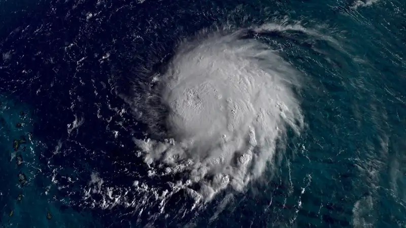


Hurricane Lee, previously a Category 5 storm, has slightly weakened to a Category 4 hurricane, but still remains a powerful and destructive force. With maximum sustained winds of 155 mph, it currently sits approximately 550 miles east of the northern Leeward Islands. According to the National Hurricane Center, while there may be slight fluctuations in its maximum winds over the next few days, Lee will continue to be a major hurricane in the southwestern Atlantic early next week. Though it is too soon to determine if it will directly impact the US mainland, the storm's fast and remarkable intensification is cause for concern.
Lee's rapid intensification was unprecedented, doubling its wind speeds within a single day. In a 24-hour period, the storm's winds increased by an astonishing 85 mph, tying it with Hurricane Matthew as the third-fastest rapid intensification in Atlantic history. Hurricane Matthew devastated Haiti in 2016 and wreaked havoc in parts of the southeastern United States. This level of rapid intensification is extremely rare and highlights the extraordinary power of Hurricane Lee.
As Hurricane Lee continues to move, dangerous surf and rip currents are expected to affect the northern Caribbean and eventually reach the mainland US by Sunday. The storm's center will pass north of the Leeward Islands, the Virgin Islands, and Puerto Rico over the weekend and early next week. These areas could experience tropical storm conditions, life-threatening surf, and rip currents.
Lee now joins a select group of storms that have reached Category 5 strength, a distinction achieved by only 2% of hurricanes in the Atlantic. Since 1924, only 40 Category 5 hurricanes have been recorded in this ocean basin. With sustained winds of 165 mph, Hurricane Lee ranks among the strongest hurricanes ever recorded in the Atlantic. Reaching such strength requires a combination of warm water, moist air, and light upper-level winds. Lee encountered all these ideal conditions, buoyed by record warm sea-surface temperatures.
Interestingly, the occurrence of Category 5 hurricanes has become more frequent in recent years. Lee is the eighth storm to achieve this level of intensity since 2016, representing 20% of all Category 5 hurricanes in the Atlantic since reliable records began. This increase in extremely powerful hurricanes may be linked to the warming oceans and changing climate patterns.
The potential impact of Hurricane Lee on the US remains uncertain. Computer models indicate that the storm will eventually turn north, but the precise timing and how far west it will track will determine its proximity to the East Coast. The Bermuda High, an area of high pressure over the Atlantic, will play a crucial role in Lee's path as it weakens and allows the storm to shift northward. Additionally, the position of the jet stream, strong upper-level winds, will influence whether Lee veers closer to the US or stays away.
Possible scenarios include Lee making a quick turn northward, keeping it further away from the US and potentially closer to Bermuda. Alternatively, if the high pressure remains stronger and the jet stream sets up along the East Coast, Lee could take a slower turn northward, bringing it closer to portions of the East Coast, particularly north of the Carolinas. These factors are still uncertain, as Lee is at least seven days away from posing a threat to the US. More clarity on any potential impact will emerge as the storm progresses westward in the coming days.